


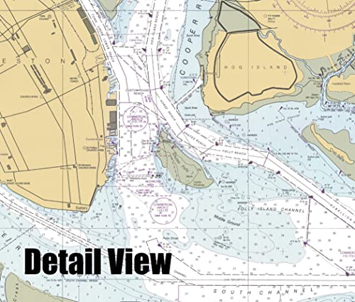

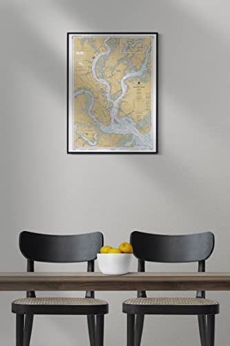
Historic Pictoric Map – Charleston Harbor, 1996 Nautical NOAA Chart – South Carolina (SC) – Vintage Wall Art – 18in x 24in
$33.99 (as of 07/07/2026 23:41 PST - DetailsProduct prices and availability are accurate as of the date/time indicated and are subject to change. Any price and availability information displayed on Amazon at the time of purchase will apply to the purchase of this product.)
Add style to any room’s decor with this beautiful decorative print. Whether your interior design is modern, rustic or classic, a map is never out of fashion
Description
- VINTAGE MAP REPRODUCTION: Add style to any room's decor with this beautiful decorative print. Whether your interior design is modern, rustic or classic, a map is never out of fashion
- MUSEUM QUALITY INKS AND PAPER: Printed on thick 192gsm heavyweight matte paper with archival giclee inks, this historic fine art will decorate your wall for years to come
- ARTWORK MADE TO ORDER IN THE USA: We make each reprint only when you order it. Every antique map is edited for image quality, color and vibrance, so it can look its best while retaining historical character. Makes a great gift!
- FRAME READY: Your unframed poster ships crease-free, rolled in a sturdy mailing tube. Many maps fit easy-to-find standard size frames 16×20, 16×24, 18×24, 24×30, 24×36, saving on custom framing
- Watermarks will not appear in the printed picture. Old maps sometimes have blemishes, tears, or stamps that may be removed from the final print
Additional information
| Manufacturer | |
|---|---|
| Product Group | |
| Part Number | 502349 |
| Product Dimensions | 24 x 18 x 0.20 inches |
| Item Weight | 0.50 Pounds |
| Size | |
| Number Of Items | 1 |
Related products
-

Paradise Cay Publications, Inc. Decorative Nautical Chart – NOAA Chart 11006, Art Print Quality Map, Suitable for Framing. Wall Art, Printed on Demand. Ships Rolled.
$32.95 Learn More -

Alaska 3-D Nautical Wood Chart, 24.5 in x 31 in
$375.00 Learn More -

Historic Pictoric Map – Savannah River And Wassaw Sound, 1990 Nautical NOAA Chart – Georgia, South Carolina (GA, SC) – Vintage Wall Art – 30in x 24in
$49.99 Learn More -

Decorative Nautical Chart – NOAA Chart 18521, Art Print Quality Map, Suitable for Framing. Wall Art, Printed on Demand. Ships Rolled.
$19.90 Learn More -

Historic Pictoric Vintage Map – Admiralty Inlet and Puget Sound, WA, 1983 Nautical NOAA Chart – Vintage Wall Art – 24in x 36in
$59.99 Learn More -

Historic Pictoric Vintage Map – Wickford Harbor, Rhode Island, 1942 Nautical NOAA Chart – Rhode Island (RI) – Vintage Wall Art – 24in x 30in
$59.99 Learn More -

Historic Pictoric Vintage Map – Boston Harbor, 1996 Nautical NOAA Chart – Massachusetts (MA) – Vintage Wall Art – 24in x 18in
$49.99 Learn More -

Historic Pictoric Map – Shinnecock Bay to Great South Bay, 1961 Nautical NOAA Chart – New York (NY) – Vintage Wall Art – 44in x 36in
$109.99 Learn More -

Historic Pictoric Vintage Map – Mosquito Lagoon to Eau Gallie, 1940 Nautical NOAA Chart – Florida (FL) – Vintage Wall Art – 36in x 58in
$159.99 Learn More -

NOAA Historical Map and Chart Collection 14×18 Black Modern Framed Art Print Titled Nautical Chart – Narragansett Bay ca. 1975 – Sepia Tinted
$54.99 Learn More -

Inside Passage, Alaska 3-D Nautical Wood Chart, Grey Frame, 13.5" x 43"
$346.00 Learn More -

Historic Pictoric Vintage Map – Santa Catalina Island, CA, 1977 Nautical NOAA Chart – Vintage Wall Art – 33in x 24in
$59.99 Learn More