
Sale!


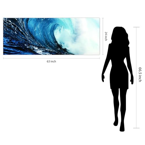
Empire Art Direct Blue Wave 2 Frameless Free Floating Tempered Glass Panel Graphic Wall Art, 24" x 63" x 0.2", Ready to Hang
Original price was: $136.99.$123.29Current price is: $123.29. (as of 01/16/2026 15:32 PST - DetailsProduct prices and availability are accurate as of the date/time indicated and are subject to change. Any price and availability information displayed on Amazon at the time of purchase will apply to the purchase of this product.)
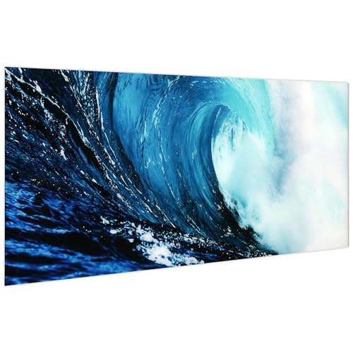
This piece shows a truly perfect wave, captured in that quintessential shape of an arcing curve, with the foam Raging where the wave descends into itself
Description
- FRAMELESS TEMPERED GLASS WALL ART – This piece shows a truly perfect wave, captured in that quintessential shape of an arcing curve, with the foam Raging where the wave descends into itself
- PROTECTION & INSTALLATION – Such a large beautiful wave wall art, no damage when delivering in carton with high-strength Styrofoam and protective corners; Comes with pre-installed steel hangers for installation
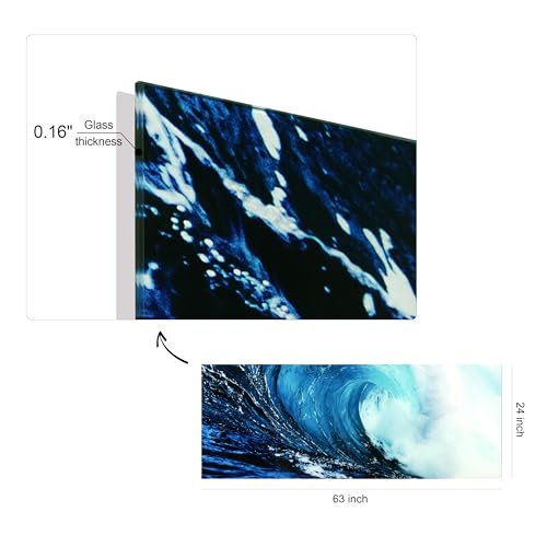
- PRODUCT TECHNIQUES – Digital super high resolution had printing Artwork, picture is reverse printed on ultra white tempered glass; Vivid color create the feel of Natural and masterpiece, bring a immersive experience to you; Waterproof, color fading-resistant and easy-cleaning
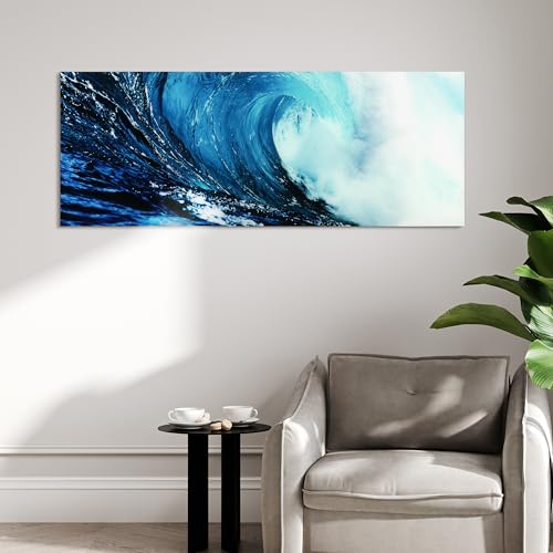
- GIFT & PERFECT DECORATION – This frameless glass wall art is a perfect gift for Christmas, Thanksgiving, Mother's day, Father's day, birthday, etc; It's also a addition for living room, bedroom, bathroom, dining room, office, hotel and bar
Additional information
| Brand | Empire Art Direct |
|---|---|
| Manufacturer | Empire Art Direct |
| Binding | Kitchen |
| Product Group | Home |
| EANs | 0028201500921 |
| UPCs | 028201500921 |
| Item Part Number | TMP-EAD5009B-2463 |
| Model | Blue Wave 2 |
| Color | Blue |
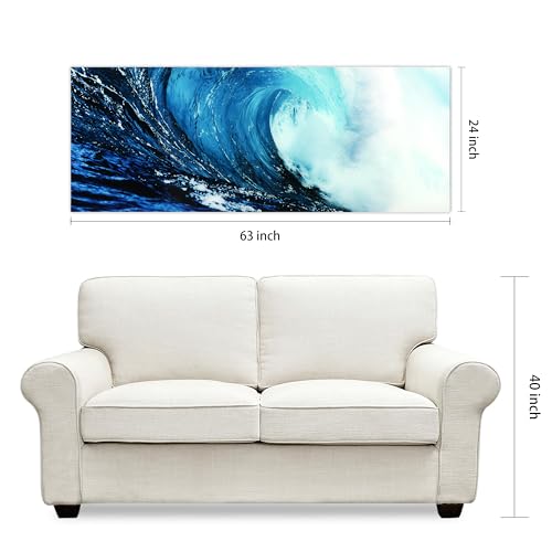
| Product Dimensions | 63 x 24 x 0.20 inches |
| Item Weight | 22 Pounds |
| Size | 63"L x 24"W |
| Unit Count | 1 |
Related products
-

Historic Map : U.S. Coast Survey Nautical Chart or Map of The Florida Keys and Key West, 1859, Vintage Wall Art : 24in x 32in
$59.99 Learn More -

Historic Pictoric Vintage Map – Point Judith Harbor, 1998 Nautical NOAA Chart – Rhode Island (RI) – Vintage Wall Art – 36in x 44in
$109.99 Learn More -

ArtDirect Nautical Chart – Cape Cod Bay ca. 1970 14×11 UnFramed Art Print Poster Ready for Framing by NOAA Historical Map and Chart Collection
$19.99 Learn More -

Historic Pictoric Map – Islands in Lake Erie Including Sandusky Bay, Ohio, 1931 Nautical NOAA Chart – Ohio (OH) – Vintage Wall Art – 16in x 24in
$49.99 Learn More